NOAA stands as America’s go-to source for space weather forecasts. Through its National Weather Service division, it runs high-tech satellite systems and prediction centers.
The agency teams up with NASA, commercial space operators, and international partners to help protect both civilian and commercial space activities from solar storms and radiation events. That’s a pretty big job, honestly.
NOAA officially handles space weather forecasting for the entire United States. It keeps a close eye on solar activity and sends out crucial warnings that help protect commercial spaceflight and satellite infrastructure.
The National Environmental Satellite, Data, and Information Service (NESDIS) builds and operates specialized satellites. These satellites gather data on solar phenomena before anything reaches Earth’s atmosphere.
NOAA’s Office of Space Weather Observations runs operational satellite systems dedicated to monitoring space weather. The office offers real-time data so forecasts stay accurate and warnings get out quickly—especially for space tourism operators.
Key responsibilities include:
NOAA launched the SWFO-L1 spacecraft, which is the first satellite fully dedicated to operational space weather forecasting. This mission travels a whopping one million miles to watch solar wind and provide nonstop observations.
The Space Weather Prediction Center works as a specialized division within the National Weather Service. It’s based in Boulder, Colorado, and acts as the main hub for space weather operations that affect commercial spaceflight.
In 2023, SWPC upgraded its advanced, physics-based models to boost lead times for predicting geomagnetic storm impacts. These changes directly help satellite operators and space tourism companies by offering earlier warnings about risky conditions.
The center rolled out its Space Weather Prediction Testbed in 2025. This facility lets forecasters and commercial space operators run realistic simulations together.
SWPC services include:
At the testbed, commercial space companies train alongside NOAA forecasters. This kind of teamwork means space tourism operators get the most up-to-date and accurate space weather info possible.
NOAA works hand in hand with NASA to support government and commercial space missions. NASA pushes scientific understanding forward, while NOAA delivers the operational forecasting services that the space tourism industry really depends on.
The Artemis II exercise in April 2025 showed just how well this partnership works. More than 70 people from NASA, the Department of Defense, commercial space companies, and universities worked together on realistic scenarios.
Commercial space operators count on NOAA’s expertise to protect their spacecraft and passengers. The agency provides services that are honestly mission-critical for safe space tourism during all sorts of space weather.
Partnership benefits include:
NOAA’s international collaborations extend its reach beyond the US. These partnerships help global space tourism operators get reliable space weather info—no matter where their launches happen.
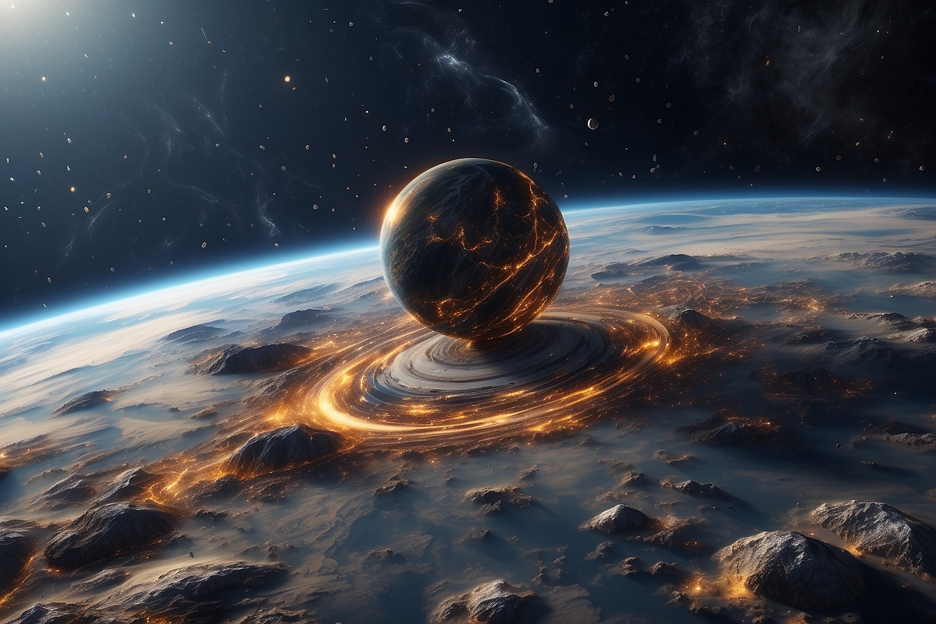
Space weather covers the ever-changing conditions throughout the solar system that directly impact Earth’s technology and human activity. The main pieces? Energetic particles, electromagnetic radiation, and magnetic field changes—all kicked off by solar activity.
Space weather describes the changing conditions in the space between the sun and Earth. These conditions can impact both orbiting and ground-based technology.
This phenomenon happens anywhere from the sun’s surface down to Earth’s surface. Unlike regular weather, space weather deals with particles, electromagnetic energy, and magnetic fields—not temperature or rain.
Primary components include solar radiation, charged particles, and magnetic field fluctuations. These elements interact with Earth’s magnetosphere, ionosphere, and upper atmosphere.
Solar flares are one major type of space weather event. These eruptions blast out huge amounts of electromagnetic radiation, lasting from just a few minutes up to hours.
Coronal mass ejections (CMEs) make up another big category. These events throw out big blobs of plasma and magnetic field material from the sun’s corona into space.
Geomagnetic storms kick off when solar wind changes hit Earth’s magnetic field. These disturbances can mess with navigation systems, power grids, and communication networks.
The sun drives all space weather events. Solar activity goes through somewhat predictable cycles, peaking about every 11 years.
Solar wind flows outward from the sun all the time. It’s mostly protons and electrons in plasma form, and it carries magnetic fields that interact with Earth’s magnetosphere.
Sunspots show up as darker areas of intense magnetic activity on the sun. These often come before major events like flares and CMEs.
The solar corona features regions called coronal holes, which show up as dark patches in extreme ultraviolet images. These holes let high-speed solar wind streams escape more easily.
Earth’s magnetosphere and ionosphere change how space weather impacts the planet. The magnetosphere blocks most harmful radiation, while the ionosphere can either amplify or reduce effects on radio communications and navigation.
NOAA uses three main scales to measure space weather events that can disrupt commercial spaceflight and satellite communications. These scales rate geomagnetic storms, solar radiation storms, and radio blackouts using severity levels—kind of like how we rate hurricanes.
The NOAA Space Weather Scales give clear severity ratings for three types of space weather disturbances that affect spacecraft. Space tourism companies pay close attention to these classifications when making launch and safety decisions.
Geomagnetic Storms (G-Scale) run from G1 (minor) to G5 (extreme) and measure disturbances in Earth’s magnetic field. These storms can cause satellite tracking issues and navigation errors—both of which matter a lot for commercial spaceflight.
Solar Radiation Storms (S-Scale) range from S1 to S5 and show how dangerous particle radiation from the sun can get. Commercial space operators often delay launches during severe radiation events to keep passengers and crew safe.
Radio Blackouts (R-Scale) measure communication disruptions from R1 (minor) to R5 (extreme). These events can cut off ground control contact with spacecraft for hours, which is a nightmare scenario for any mission.
Each scale includes data about how often events happen during the 11-year solar cycle. Space tourism operators use this info to plan launches and manage risks.
Radio blackout classifications directly affect when commercial spacecraft can launch and keep ground communications. The R-scale measures solar flare intensity and resulting communication disruptions on the sunlit side of Earth.
R1 events cause weak high-frequency radio problems and occasional contact loss. These minor blackouts pop up about 950 days per solar cycle, and most space operations keep going with backup comms.
R2 moderate blackouts mean limited communication loss for tens of minutes. Space tourism flights usually continue with extra monitoring during these roughly 300-day-per-cycle events.
R3 strong events trigger wide-area radio blackouts lasting about an hour. Most commercial space operators hold off on launches during these 140-day-per-cycle disruptions to keep ground control contact.
R4 severe blackouts wipe out communication across most of the sunlit Earth for one to two hours. These rare events show up only 8 days per cycle and force all commercial launches to wait.
R5 extreme events create total radio blackouts that last several hours and happen less than once per solar cycle. Space tourism operations just stop altogether during these.
Solar radiation storms are the biggest biological threat to space tourists and force immediate mission cancellations at S1 or higher. These particle events can deliver dangerous radiation doses to anyone outside Earth’s shield.
S1 minor events have minimal impacts but happen 50 times per solar cycle. Space tourism operators keep a close watch because these can quickly turn into something much worse.
S2 and S3 moderate to strong storms expose high-altitude aircraft passengers to higher radiation risk. Commercial spacecraft must return to Earth or get everyone into shielded compartments during these events.
Space tourism companies rely on real-time particle flux measurements to track radiation. The S1 threshold starts at 10 particles per square centimeter, but extreme S5 storms can hit 105 particles.
Passenger protection protocols require missions to end immediately if radiation levels go past S2. Space hotels and orbital platforms have heavily shielded safe rooms for tourists to shelter in during sudden radiation storms.
Ground-based space tourism training facilities run radiation exposure drills to get civilian astronauts ready for emergency procedures on real missions.
Space weather scale impacts drive every decision in commercial space tourism, from launch timing to in-flight safety. Tourism operators need to know how each severity level affects their spacecraft systems and how they keep passengers safe.
Power systems get more vulnerable during G3 or higher geomagnetic storms. Commercial spacecraft can suffer navigation errors and even electrical failures that could leave passengers stranded in orbit—nobody wants that.
Satellite tracking goes unreliable during G4 severe storms, especially when ground control loses accurate position data. Space tourism vehicles count on precise orbital mechanics, and that’s impossible during big geomagnetic disturbances.
Communication blackouts during R4-R5 events cut off all contact between space tourists and ground teams. If there’s a medical or mechanical emergency, nobody on the ground can help.
Radiation exposure limits for space tourists follow strict federal rules that commercial operators can’t break. S3 or higher events mean everyone must leave space environments fast to avoid serious health risks.
Space tourism insurance policies usually don’t cover extreme space weather events above certain thresholds. Passengers should know this before they book a commercial spaceflight.

NOAA delivers real-time space weather data using multiple monitoring systems that track solar activity and its effects on Earth. The Space Weather Prediction Center sends out daily reports with 24-hour maximums and detailed solar summaries.
NOAA’s Space Weather Prediction Center runs nonstop monitoring systems that give live updates on space weather. The center tracks solar wind speed, magnetic field strength, and radio flux levels.
Current monitoring shows solar wind speeds and magnetic field data getting updated all the time. The 10.7cm radio flux is a key indicator of solar activity.
The SWFO-L1 mission will boost monitoring once it launches. This satellite will watch solar eruptions and incoming space weather events around the clock. The system will push out early warnings to protect communication and navigation.
Space weather alerts use a scale similar to regular weather warnings. The center issues Alerts, Watches, and Warnings based on what solar activity might do. These bulletins help the public figure out how serious a space weather event could get.
The Space Weather Prediction Center tracks the highest observed conditions over 24-hour periods using its standardized scales. These focus on radio blackouts (R-scale) and solar radiation storms (S-scale).
Radio blackout events range from R1-R2 minor disruptions to R3-R5 severe impacts. Solar radiation storms use S1 or higher to show particle event intensity.
Current conditions show weak to minor HF radio communication issues on Earth’s sunlit side. Navigation systems can have brief low-frequency signal problems during active times.
The monitoring system logs geomagnetic storm activity using Kp indices. These values go from Kp less than 5 for calm conditions up to Kp = 9 for extreme G5-level storms.
Daily space weather summaries give a rundown of solar and geomagnetic conditions. Every day at 0030 UTC, you’ll find the Summary of Space Weather Observations with the previous day’s solar region data.
Each Monday, the team in Boulder, Colorado, puts together weekly reports. NOAA’s Space Weather Prediction Center works with Air Force weather services to publish these updates.
The 27-Day Outlook lays out longer-range forecasts for radio flux and geomagnetic indices. This report helps folks plan operations that need steady space weather.
Key summary parameters include:
ICAO Space Weather Advisories keep things coordinated internationally. These reports make sure aviation and satellite operators worldwide get the same space weather info.

NOAA tracks three big solar wind parameters that directly affect space weather. Solar wind speed tells us how fast charged particles head for Earth. Magnetic field readings show storm intensity, and radio flux data hints at overall solar activity.
Solar wind speed shows how quickly charged particles shoot from the Sun toward Earth. NOAA spacecraft at the L1 Lagrange point—about a million miles out—pick up this data in real-time.
Most of the time, solar wind speeds hang between 300 and 500 kilometers per second. When things get lively, streams can surge to 600 or even 800 km/sec.
Fast solar wind can trigger stronger geomagnetic storms once it hits Earth’s magnetosphere. These speedy particles squeeze Earth’s magnetic field and can spark aurora at lower latitudes.
NOAA’s DSCOVR satellite took over as the main source for real-time solar wind speed in July 2016. Before that, NASA’s ACE satellite handled the job since 1998.
Forecasters lean on solar wind speed to estimate when storms will arrive. Faster streams suggest more intense space weather, which can mess with satellites and even power grids.
Solar wind magnetic field readings focus on two main components: Bt (total field strength) and Bz (north-south orientation). Both are measured in nanotesla (nT).
Bt usually sits between 2 and 10 nT in calm times. During storms, readings can jump past 20 nT.
Bz matters more for storm severity than strength alone. Southward Bz values (negative numbers) let solar wind connect with Earth’s magnetic field, sending energy into the magnetosphere and stirring up geomagnetic disturbances.
Northward Bz (positive) works more like a shield, bouncing particles away and easing storm impacts.
NOAA forecasters keep an eye out for Bz values dropping below -10 nT for a while. That’s when moderate to strong geomagnetic storms tend to hit, affecting radio and satellite operations.
The noon 10.7cm radio flux tracks solar radio emissions at a certain wavelength. Measurements come in solar flux units (sfu) and always happen at local noon.
Radio flux numbers link up directly with solar activity. When the Sun is quiet, readings hover around 70 to 80 sfu. Sunspots and flares can push those numbers above 200 sfu.
Scientists use this as a stand-in for extreme ultraviolet radiation from the Sun. Higher flux means more solar output, which changes the density of Earth’s upper atmosphere.
Satellite operators watch flux data to predict atmospheric drag on spacecraft. More solar activity heats the air, causing low-Earth orbit satellites to lose altitude faster.
NOAA folds flux readings into its forecasting models. That helps predict ionospheric disturbances, which can throw off GPS and high-frequency radio.
Space weather can really mess with radio systems and navigation signals that planes and ships depend on. Solar flares send out x-rays that block high-frequency radio, while geomagnetic storms interfere with low-frequency navigation used for positioning and guidance.
Solar flares blast intense x-ray bursts that hit HF radio communication across the sunlit side of Earth. These flares affect frequencies between 3-30 MHz, which are vital for aviation, ships, and emergency crews.
Radio blackout storms can wipe out HF signals for minutes or even hours. Airlines sometimes lose contact with planes flying over the poles, where satellite coverage isn’t great.
Emergency teams struggle with communication gaps during disasters. During Hurricane Maria in 2017, solar flares took out HF radio links that rescue crews needed across the Caribbean.
The impact depends on how strong the flare’s x-ray output is. Minor events might just weaken signals or cause brief dropouts. Major flares can cause total blackouts, forcing airlines to reroute or delay flights.
HF radio systems don’t have many technical workarounds for this. Operators mostly wait it out until space weather calms down.
Low-frequency navigation signals take a hit during geomagnetic storms and solar particle events. These signals are crucial for GPS, LORAN, and differential GPS systems.
Solar storms shake up the ionosphere, causing signal scintillation. Navigation signals from satellites to ground receivers get scattered and delayed in the disturbed atmosphere.
GPS accuracy drops sharply when space weather gets rough. Survey jobs that need pinpoint accuracy become impossible. Aircraft might have to switch to backup navigation.
Low-frequency navigation below 2 MHz gets hit the hardest. Harbor approach systems and airport landing aids rely on these signals.
Ships lose positioning accuracy if their navigation gear gets disrupted. Commercial shipping might slow down or hold off on port entries until things settle.
Space weather events start with solar activity and ripple through Earth’s magnetosphere. Solar flares and coronal mass ejections (CMEs) cause the biggest disruptions, while geomagnetic storms can mess with satellites and create gorgeous aurora.
Solar flares are huge bursts of electromagnetic radiation from the Sun’s surface. These events release energy on a scale that’s honestly hard to imagine—billions of hydrogen bombs’ worth, all in a few minutes or hours. The radiation travels at light speed and hits Earth in about eight minutes.
Coronal Mass Ejections (CMEs) often follow solar flares, sending out gigantic plasma clouds. These can carry billions of tons of charged particles flying up to 3,000 kilometers per second. CMEs bring their own magnetic fields, which can shake up Earth’s magnetosphere.
The solar flare classification system uses letters:
Radio blackouts hit immediately when flare radiation reaches Earth’s daytime side. High-frequency communications get hit hardest. Flights over the poles often need rerouting during the biggest events.
Geomagnetic storms kick in when CMEs collide with Earth’s magnetic field. The magnetosphere gets squashed and twisted as solar wind pressure ramps up. These storms can last several days.
NOAA’s G-scale ranks geomagnetic storms from G1 to G5. G1 means minor power grid blips and animal navigation issues. G5 is the big one—think transformer damage and massive blackouts.
Satellites run into all sorts of trouble during storms. Atmospheric drag goes up, shortening the life of satellites in low-Earth orbit. Radiation levels spike in the Van Allen belts, which can fry electronics.
GPS accuracy drops off during stormy periods. Position errors can jump from a few meters to tens of meters. The ionosphere gets so disturbed that radio waves start acting unpredictably.
Power grids pick up extra currents in long transmission lines. Northern regions take the brunt because they’re closer to the magnetic pole.
Auroras light up when charged solar wind particles smash into atmospheric gases. This happens anywhere from 80 to 600 kilometers above the ground. Aurora borealis glows in the north, while aurora australis shines in the south.
Colors depend on what’s in the air and how high up the action is. Oxygen gives green and red, nitrogen adds blue and purple. Most green auroras show up between 100 and 300 kilometers altitude.
Geomagnetic storms let auroras creep farther south. During big G4 and G5 events, people in Alabama or Northern California might catch the show. That’s a rare treat for millions.
Aurora intensity tracks with solar activity. CME hits make for wild, bright displays. Substorms bring sudden bursts and fast-moving lights.
Real-time aurora forecasts help photographers and travelers plan trips. The 30-minute aurora forecast gives up-to-date visibility for North America.
NOAA runs advanced forecasting to predict space weather and send out warnings that protect satellites, power grids, and networks. The National Weather Service manages these alerts with standardized scales and updates.
NOAA’s Space Weather Prediction Center uses high-tech monitoring to keep tabs on solar activity and its effects on Earth. The center sends out forecasts for everything from solar flares to geomagnetic storms.
They rely on real-time satellite data from the space between Earth and the Sun. These satellites watch solar wind and give early warnings.
NOAA tailors forecast products for different audiences. Technical discussions go to scientists and engineers. Bulletins make things clear for the public. Scale values help people quickly size up the risk.
The SWFO-L1 mission is NOAA’s latest leap in space weather monitoring. This satellite watches for solar eruptions 24/7 and helps make forecasts more accurate.
The NWS Space Weather Prediction Center sends out three main notifications: Alerts, Watches, and Warnings. These look a lot like regular weather bulletins but focus on solar impacts.
Space Weather Advisories come out every Monday, describing last week’s conditions. They also include seven-day outlooks based on NOAA’s Space Weather Scales.
The scale system rates severity from minor to extreme:
NOAA’s websites show current conditions with real-time updates. The system tracks HF radio issues, navigation signal trouble, and satellite drag. Operators use this info to protect key infrastructure when space weather acts up.
NOAA is working on better space weather monitoring with its Space Weather Next program and upgraded ground systems. These projects will swap out old satellites and boost observation abilities well into the 2030s.
The Space Weather Next program is NOAA’s big-picture plan to keep space weather observations going strong, even after current missions end. SW Next steps in for aging satellites like SOHO, ACE, and DSCOVR, which honestly don’t have much time left.
Key program objectives include:
The program targets three crucial orbital spots. SW Next keeps watch at geosynchronous and low Earth orbits, building on what GOES-R and POES already do.
NOAA teams up with the European Space Agency for the Vigil mission, set for launch in 2031. Vigil carries NOAA’s Compact Coronagraph and will work from Lagrange Point 5, a whopping 93 million miles from Earth.
That vantage point? It lets Vigil spot solar activity heading our way before it gets too close.
Modern space weather satellites pack specialized tools for constant solar monitoring and space environment observation.
The SWFO-L1 observatory sits at Lagrange Point 1, almost a million miles toward the Sun. It’s the first operational satellite dedicated to space weather monitoring from that location.
Primary instrument capabilities include:
The Compact Coronagraph on Vigil keeps an eye on the solar corona from L5. It tracks coronal mass ejections and solar wind conditions that shake up Earth’s space environment.
NASA and NOAA run satellite development, launch, and testing. Commercial partners help build spacecraft and instruments, while NOAA manages funding and takes ownership of the program.
NOAA’s ground network handles satellite commands, data crunching, and getting products out to users. SW Next brings in commercial partners, international collaborators, and NOAA’s own systems to create a robust ground service setup.
Ground system components include:
The Wallops Command and Data Acquisition Station in Virginia uses specialized antennas for space weather satellite comms. These stations keep data flowing 24/7 for Space Weather Prediction Center forecasts and alerts.
All SW Next data goes out through the Space Weather Prediction Center and the National Centers for Environmental Information. This approach serves both real-time forecasting and research in academic and commercial circles.

NOAA offers dashboards with real-time space weather data for everyone from pilots to space tourism companies. The Space Weather Prediction Center keeps a hefty archive at NCEI for long-term research and analysis.
The Space Weather Enthusiasts Dashboard is the go-to for civilian space travelers and anyone curious about space conditions. It shows current geomagnetic activity using the familiar Kp index.
You’ll find 3-day forecasts updated twice daily at 1230 UTC. Anyone can track geomagnetic storms that might affect space tourism or satellites.
Current monitoring capabilities include:
The dashboard uses NOAA’s R-scale (radio blackouts) and S-scale (solar radiation storms). Space tourists check these before flights to see if comms might drop out.
Real-time updates highlight the highest observed 3-hour Kp values from the past day. If it’s below 4, it’s generally safe for commercial spaceflight.
Professional monitoring tools serve up deep datasets for commercial operators and researchers. NOAA’s Space Weather Prediction Center offers specialized dashboards for aviation, satellites, and spacecraft.
The National Centers for Environmental Information keeps the official long-term archive of all SWPC data. This archive spans centuries of solar and space weather records for analysis and planning.
Professional tools include:
These tools help space tourism companies make safety calls. Operators get real-time solar wind data, CME tracking, and solar flare reports.
The archive lets companies dig into past space weather when planning launches or passenger flights.

NOAA leads nationwide prep efforts through community education and strategies to protect infrastructure. Operators of critical systems get training and resources to keep services running during severe space weather.
NOAA’s Space Weather Prediction Center shares educational resources to help everyone understand space weather risks.
The agency puts out infographics and materials on social media and through community partners.
Public awareness campaigns cover everyday impacts: GPS dropouts during solar storms, airline delays from radiation, and risks to power grids.
Schools and universities get curriculum materials about space weather. NOAA scientists run workshops to boost student and teacher understanding.
Emergency managers get training on space weather hazards. This helps local authorities react quickly when solar storms threaten infrastructure.
NOAA keeps media channels open. Weathercasters and broadcasters get regular updates and training to share space weather risks with the public.
Power grid operators use prep checklists from NOAA partnerships. These include voltage regulation, transformer protection, and load shedding steps for geomagnetic storms.
Satellite operators act on NOAA’s forecasts. They shut down sensitive systems, tweak orbits, or switch to backups if solar particles threaten spacecraft.
Airlines get early warnings about radiation on polar routes. Planners reroute or lower flights to protect passengers and crew.
Key Infrastructure Protection Measures:
Emergency teams run regular drills for space weather scenarios. These exercises test coordination among agencies, utilities, and local officials.
Critical facilities review and update procedures every year for space weather. This means refreshing plans, training teams, and testing backup comms.
NOAA boosts space weather work by teaming up with universities and coordinating globally to share vital data. These collaborations sharpen forecasts and expand research across agencies and countries.
NOAA teams up with universities and research centers to push space weather science forward. The agency and academic partners develop new models and improve predictions.
Research partnerships help turn lab breakthroughs into real-world forecasting tools. Universities bring expertise in solar physics, the magnetosphere, and the upper atmosphere.
The PROSWIFT Act sets up formal ways to move research into operations. This law requires agencies to make clear paths for academic findings to become practical forecasting tools.
NOAA’s Space Weather Prediction Center works with institutions nationwide to build better algorithms for solar storm forecasts.
Academic researchers get access to NOAA’s operational data. This real-world info helps test and refine their models.
International partnerships help NOAA widen its space weather monitoring. The agency works with foreign space agencies to swap observations and forecasts.
Global data sharing boosts prediction accuracy. Real-time info from different countries gives a fuller picture of solar activity.
NOAA joins rideshare missions and hosted payloads with global partners. These deals cut costs and expand coverage in space.
Data exchange agreements let NOAA tap into foreign satellites. This fills coverage gaps in the monitoring network.
Joint modeling projects combine expertise from around the world. These collaborations build better forecasting tools for everyone.
NOAA and international partners work together on new tech. Sharing research avoids duplication and speeds up the development of next-gen instruments.
Space weather can mess with satellite comms, GPS, and power grids across the U.S. Solar storms disrupt commercial spaceflight and sometimes put on a pretty wild aurora show.
Solar activity runs on an 11-year cycle, swinging from quiet (solar minimum) to wild (solar maximum). During solar minimum, the sun might not show a single sunspot for days. At solar maximum, you could see hundreds each day.
Space weather conditions shift fast—sometimes calm, sometimes stormy within minutes. Solar flares shoot out bursts of radiation that hit Earth right away if they’re on the sun’s Earth-facing side.
Coronal mass ejections (CMEs) send massive plasma clouds barreling through space at up to 2 million miles per hour. They only hit Earth if they’re pointed at us. High-speed solar wind streams come from coronal holes near the sun’s equator and hit Earth when those holes line up just right.
NOAA’s Space Weather Prediction Center offers real-time monitoring with ground and space sensors. The team pulls data from satellites like SOHO and ACE.
Space weather forecasters check current conditions using a global network of optical observatories. These sites report on sunspots and other solar phenomena.
The center issues forecasts, watches, warnings, and alerts for anyone affected by space weather. Updates include instant flare impacts, solar particle arrivals (in 20 minutes to a few hours), and plasma cloud arrivals (in 30 to 72 hours).
GPS systems lose accuracy when solar outbursts shake up the ionosphere. High-precision GPS users—about 333,000 in the U.S.—feel it the most.
Electric power grids can get unwanted currents during big geomagnetic storms. A National Academy of Sciences report put possible grid collapse costs at $1 trillion.
Airlines can’t use polar routes during solar radiation storms. Comms can drop out, and navigation gets less reliable. Rerouting flights can cost airlines over $100,000 per trip.
Satellites face more radiation at high altitudes and extra drag in low Earth orbit. The satellite industry is worth over $100 billion worldwide.
Auroras happen when solar mass ejections hit Earth’s magnetic field. Electric currents flow in the upper atmosphere, lighting up the northern and southern lights at both poles.
Space weather forecasters track geomagnetic storms that energize particles in the magnetosphere. These storms heat up the atmosphere and set off the auroras.
NOAA posts aurora forecasts using real-time solar wind and magnetic field data. These predictions help you know when and where to catch the lights at different latitudes.
NOAA’s space weather forecasting starts with near-real-time observations. They pull data from both ground and space-based instruments.
Forecasters look at the conditions from the sun all the way to Earth. They rely on current environmental data to make sense of what’s happening.
At the prediction center, experts analyze the sun’s 27-day recurring pattern. This cycle lets them spot when active regions will swing around to face Earth again.
They also compare what’s happening now to similar situations from the past. Forecasters use numerical models—kind of like the ones in regular weather prediction—to help estimate what’s coming, sometimes just hours ahead, sometimes weeks.
Sunspot complexity plays a big role in predicting flares. If sunspot groups look more tangled or complicated, the odds of a solar flare (and space weather impacts) go up.
Space weather usually targets technology, not people directly. Still, you might want to get ready for power grid problems or sudden communication blackouts.
GPS navigation can lose its mind during a big storm—sometimes it just stops working. If you’re traveling, it’s smart to bring a backup map or another way to find your way, instead of trusting just your phone.
Radio signals, especially high-frequency ones, can just vanish. This creates real headaches for emergency services and pilots when a major event hits.
Satellite internet and TV might glitch out or go down for a while. It’s a good idea to have another way to stay in touch if you know a severe space weather event is coming.