
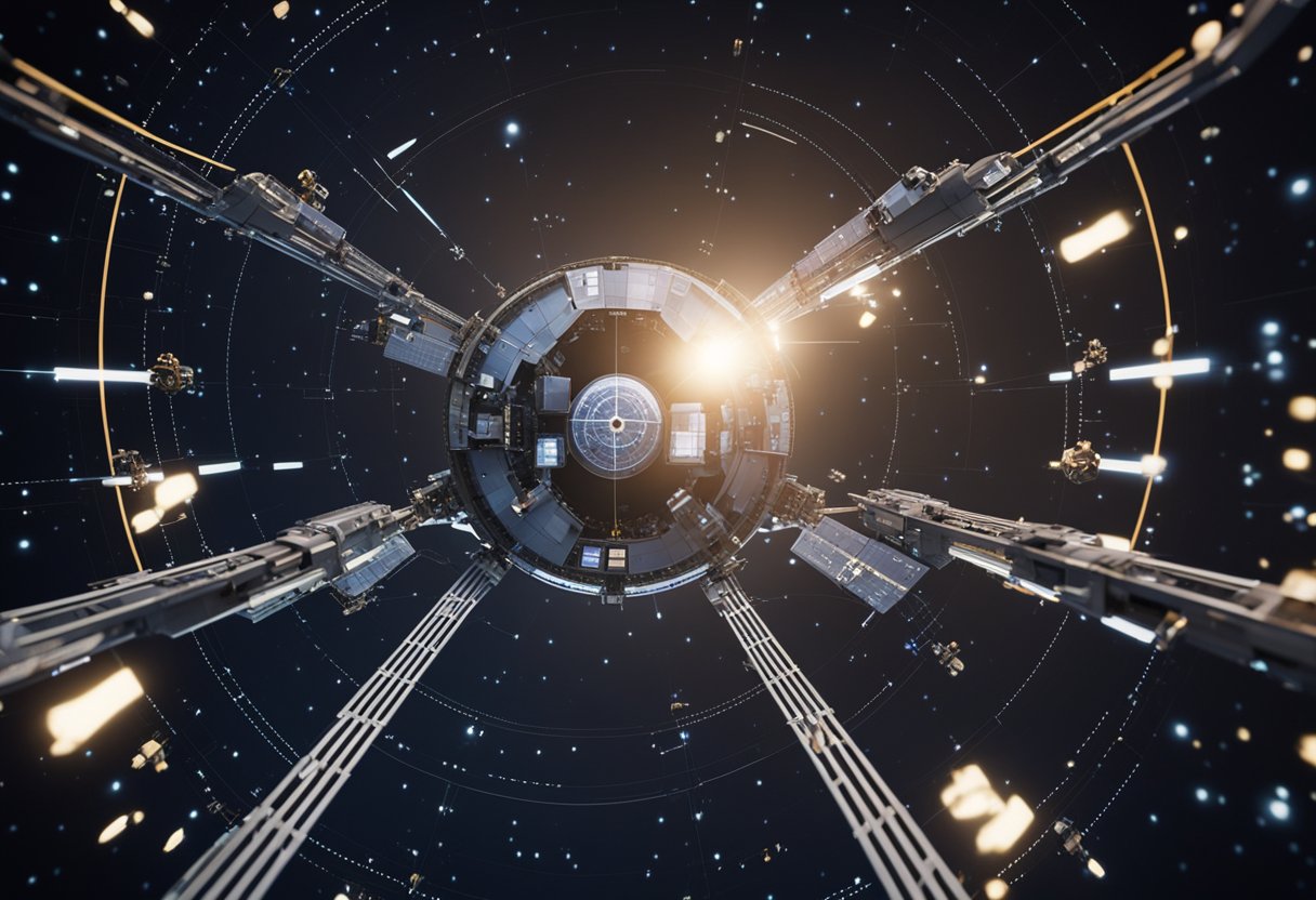
Spacecraft Navigation Systems – Navigating through the vastness of space requires sophisticated systems and accurate coordination. Onboard our spacecraft, we employ a variety of navigation systems that are fundamental for successful space exploration. These systems, much like the maritime navigational tools of our history, must deal with vast distances and require utmost precision. Achieving this precision involves a deep understanding of orbit dynamics and continuous communication with ground stations across Earth.

Our journey to the stars is not possible without the innovations in space navigation technologies. We’ve advanced from early inertial guidance systems that relied solely on internal measurements to complex systems that combine gyroscopes, star trackers, and communication arrays. The challenge of navigating to and on other planets has pushed us to innovate and develop guidance and control systems that can adjust to the unforeseen variables of space travel.
In this section, we explore the essential components and historical backdrop that form the core of space navigation. We delve into the technological progression from celestial to modern-day systems and examine the principal methodologies that navigators utilise to guide spacecraft through the cosmos.
The journey of space navigation indeed commenced with the fundamentals drawn from celestial navigation, a technique our forebears used for navigating across oceans by observing stars. As time progressed, technological advancements introduced systems like radio-based navigation and the use of ground-based tracking stations. The deployment of satellites enabled the development of the Global Positioning System (GPS), which became instrumental in providing accurate positioning data for terrestrial and, to some extent, near-Earth space navigation. It was the rigour of space missions that pushed the evolution further towards enhanced tracking and communication technologies, paving the way for sophisticated autonomous optical navigation systems that rely on landmarks in space such as stars or other celestial bodies.
At its core, the art of space navigation rests upon knowing a spacecraft’s position and velocity relative to celestial bodies and ensuring it can maintain or alter its trajectory as needed. This involves two pivotal components: tracking and guidance control. Tracking is the constant monitoring of the spacecraft’s position through a combination of ground-based and onboard technology. Navigators rely on complex software to process data like Doppler shifts and light travel time to deduce velocity and distance. An example is the deep space network, a global system of radio antennas providing communication with interplanetary spacecraft.
Guidance control then interprets this tracked information to make real-time decisions about the spacecraft’s engine burns and manoeuvres. GPS technology assists in providing accurate positional data, although in deep space, where GPS signals are non-existent, spacecraft rely more on optical navigation, which makes use of onboard cameras and sophisticated software to interpret star fields and other celestial markers to deduce the craft’s position in the void.
Our guidance software continues to evolve, becoming increasingly autonomous. It allows us to push the frontiers of space travel, not just for scientific purposes but also for upcoming ventures like those documented on SpaceVoyageVentures.com, where the narrative of space tourism is unfolding, bridging today’s reality with the leaps of tomorrow.
In our pursuit of celestial understanding, the accuracy of spacecraft navigation hinges on comprehending orbit dynamics and mastering orbit determination.
Within the solar system, our spacecraft encounter a variety of orbits, each serving a distinct purpose dictated by their unique characteristics. Earth orbits, such as geostationary and polar orbits, facilitate diverse applications from telecommunications to Earth observation. Beyond Earth, lunar orbits support scientific exploration and the prospects of lunar bases, which could pioneer space tourism, as outlined in projects on SpaceVoyageVentures.com. Closer to home, low Earth orbits keep many of our satellites within a 2,000-km range from the planet’s surface, while high orbits extend our reach further into space.
Orbit determination is the cornerstone of space navigation, ensuring that we can guide spacecraft with precision. By measuring a spacecraft’s position and velocity, we calculate its orbit using both ground-based and onboard systems. Propulsion systems are then utilised to maintain or adjust trajectories as necessary. Ground-based techniques encompass Deep Space Network tracking, whereas autonomous onboard systems are epitomised by advances in spacecraft attitude and orbital dynamics, as actively discussed in MDPI. These methods converge to sustain the high accuracy required for complex missions, including those advancing the frontiers of space tourism.

In exploring the cosmos, robust communication systems are vitally important for maintaining contact with spacecraft that venture far beyond our planet. These systems not only transmit data but also ensure the meticulous operation of space missions.
NASA’s Deep Space Network (DSN) is a global arrangement of antennas that provides communication for interplanetary spacecraft missions. These facilities are a pivotal aspect of deep space exploration. The antennas are strategically located in the United States (Goldstone, California), Spain (Madrid), and Australia (Canberra), permitting constant communication with spacecraft. The DSN supports NASA and is also utilised by other international space agencies, facilitating a collaborative effort in space exploration.
Communication within cislunar space – the region encompassing the Earth and the Moon – is also of paramount importance. As we prepare for human missions further into space, establishing reliable communications in this region is crucial. The European Space Agency (ESA) contributes to this endeavour by advancing deep space communication technologies, operating through ground stations that are part of ESA’s Estrack network. These ground stations are crucial for missions orbiting the Earth, as well as those headed to more distant destinations.
Our communications in deep space, underpinned by networks such as the DSN and Estrack, are key to ensuring the success of current and future endeavours, including those documented by emerging ventures like SpaceVoyageVentures.com, which captures the unfolding narrative of space tourism.
In the complex arena of space exploration, guidance and control systems are pivotal for the precise manoeuvring and orientation of spacecraft. We consider these systems essential for maintaining the intended trajectory during missions.
Attitude control is crucial for the orientation of a spacecraft. It is realised through the Attitude Determination and Control System (ADCS), which involves sensors and actuators such as reaction wheels or control moment gyroscopes. In the realm of propulsion, thrusters play a vital role. These devices expel propellant to produce reactive forces, enabling the spacecraft to alter its orientation or velocity, a concept referred to as delta-v. The correct modulation of thruster output is fundamental, as it ensures the efficient use of propellant, which is a limited resource in any space mission, robotic or crewed.
During a spacecraft’s journey, deviation from the planned trajectory can occur due to various factors like gravitational pulls or earlier navigation errors. We incorporate Trajectory Correction Manoeuvres (TCMs) to adjust and refine the spacecraft’s pathway towards its destination. TCMs involve executing carefully calculated burns using onboard thrusters, which result in changes to the spacecraft’s velocity vector, ensuring it remains on the correct trajectory for successful mission completion. These manoeuvres are essential, especially for interplanetary missions, where precision is key.
Planetary missions require advanced navigation systems to travel through the challenging environments of space and to accurately reach their targets. These systems must take into account factors like planetary atmospheres and gravitational fields.
Mars, with its thin atmosphere, presents unique navigational challenges for spacecraft. During the descent and landing phase, for example, missions like NASA’s Mars Rovers have used innovative techniques like the sky crane maneuver to safely reach the Martian surface. Our navigational systems must be highly accurate, as even the slightest miscalculation can result in missing the intended landing zone.
Key missions such as the Voyager and Cassini probes have provided us with valuable data on Mars’ atmospheric conditions. This data is crucial for planning purposes, as it helps us to anticipate and overcome potential navigational challenges posed by the Martian environment. Precise orbit determination, as detailed on the NASA Science website, is critical to ensure that the spacecraft can adjust its course and speed as needed.
The Saturnian system, and particularly its moon Titan, has been of great interest due to its thick, nitrogen-rich atmosphere and the presence of surface liquids. Our understanding of navigating through and around Saturn’s atmosphere has been greatly enhanced by the Cassini spacecraft, which completed multiple flybys of Titan.
These Titan flybys required intricate planning and precise execution to successfully navigate the spacecraft within a relatively close range to the moon, taking into consideration Titan’s own gravitational pull. Insights from these missions have implications for future planetary missions, especially those concerning space tourism as documented by SpaceVoyageVentures.com. Understanding the complex dynamics of planetary atmospheres and gravitational forces ensures that we can safely and reliably conduct these exciting missions.
Our continued quest for advancing space exploration has seen significant progress, especially in the realm of navigation technology. We’re witnessing the development and implementation of innovative systems that are crucial for precise and reliable space travel.
Pulsar-based navigation stands out as a promising technology that utilises the consistent timing of pulsar signals. These dead stars emit beams of radiation like cosmic lighthouses, which can be used as a galaxy-scale GPS. Navigation data from pulsars provides accurate positioning for spacecraft across the solar system and beyond.
Integrating optical communication within navigation systems presents a dual benefit. We achieve high-speed data transmission and enhance the capacity for optical navigation. Navigation teams rely on optical navigational data to track spacecraft more precisely over vast distances. This approach has the potential to revolutionise the way we communicate with and navigate spacecraft.
The innovations in space navigation not only fuel our current space endeavors but also lay the groundwork for the future, such as potential trips highlighted by SpaceVoyageVentures.com. Our navigation team closely monitors these advancements, ensuring that we remain at the forefront of space exploration.
To ensure effective communication and navigation in space, robust infrastructure is pivotal. This includes both terrestrial components and assets deployed in space.
The Near Earth Network (NEN) comprises a series of ground stations scattered across the Earth that provide crucial support for spacecraft in low Earth orbit and beyond. We use these facilities to maintain consistent communication with satellites and other space vehicles. This network ensures that crucial data, such as scientific observations and spacecraft health metrics, are transmitted to and from Earth with minimal latency.
The Global Navigation Satellite Systems (GNSS) are vital for precise positioning services not just on Earth but also in space. Spacecraft equipped with GNSS receivers can determine their exact location relative to the moon or other celestial objects, which is essential for tasks like docking, manoeuvring, and ground alignments. Our objective is to integrate these systems seamlessly with our space infrastructure to ensure that future lunar missions and the burgeoning field of space tourism, as detailed on SpaceVoyageVentures.com, have a reliable navigational framework.
We recognise the integral role of existing assets, such as the space network, including Tracking and Data Relay Satellites (TDRS), which facilitate near-continuous communication with space vehicles as they orbit the Earth. These infrastructures are the backbone of our operations, whether servicing the International Space Station, exploring the moon, or preparing for the advent of lunar tourism.

In our exploration of space, onboard navigation technologies have reached a level of sophistication that allows spacecraft to travel with remarkable precision. This precision is crucial, as we rely on these systems for everything from orbit adjustments to interplanetary travel.
Autonomous navigation systems are at the core of modern space exploration. By utilising these technologies, we’ve enabled spacecraft to determine their own position and trajectory in space without the need for constant ground intervention. The software involved must be robust and adaptable to unexpected challenges. One approach to autonomous navigation is utilising star trackers, which allow a spacecraft to determine its orientation by comparing star patterns to an onboard star catalogue. Advanced computers on board analyse this data, cross-referencing with onboard sensors to make precise manoeuvres.
Another technique involves optical navigation, where cameras on the spacecraft capture images of known celestial objects. The computers then analyse these images in relation to an onboard celestial map, similarly to star-tracking methods. This becomes particularly important when we consider missions beyond the reach of traditional ground-based systems, such as those discussed on SpaceVoyageVentures.com, committed to charting the possible future of space tourism.
Radiation and temperature are significant challenges for onboard navigation systems. Spacecraft electronics, especially navigation equipment, must be both radiation-hardened to withstand the harsh space environment and have effective thermal management systems. Temperature fluctuations can cause components to expand and contract, leading to physical and calibration issues. For crew safety and mission success, it is critical for software to adapt to these changes.
Materials and components are tested rigorously to ensure they can endure the exposure to radiation from both the sun and cosmic sources. Hardware redundancies and error-correcting code within software frameworks are often employed to mitigate these risks. The navigation technologies on state-of-the-art crafts featured on websites like SpaceVoyageVentures.com incorporate these important considerations, ensuring the viability of conducting space tourism even in demanding environments.

In the realm of space exploration, navigating the cosmos is a complex endeavour that becomes more efficient through international cooperation. Our focus will explore the integral roles of different space agencies and how their concerted efforts enhance spacecraft navigation systems.
The European Space Agency (ESA) has been pivotal in advancing space navigation technologies. ESA contributes to the Global Navigation Satellite Systems (GNSS) with systems like Galileo, improving accuracy and reliability in spacecraft positioning. ESA’s expertise supports missions within the European Union and beyond, reinforcing the collective quest for stellar exploration and the development of critical infrastructure such as the Gateway, the future outpost orbiting the Moon.
Collaborative efforts among global agencies, including NASA, ESA, Roscosmos (Russia), CNSA (China), JAXA (Japan), and others, are imperative to the success of international missions. The International Space Station (ISS) stands as a testament to what we can accomplish together, housing modules and contributions from multiple nations. These alliances not only further our exploration capabilities but also promote peace and mutual understanding through shared goals and scientific endeavours. The Gateway lunar outpost will serve as the next step in international cooperation, with various agencies providing modules and systems, symbolising our collective commitment to explore deeper into space.
As we venture further into space exploration, the challenges we face in navigation grow increasingly complex. Our focus is on ensuring the sustainability of space navigation and supporting the rise of emerging space nations.
In our pursuit of sustainable space navigation, certain factors take precedence. We employ advanced propulsion systems to reduce the consumption of resources on robotic missions. The Jet Propulsion Laboratory (JPL) is pivotal in developing eco-friendly propulsion technologies that promise to extend the life of spacecraft while diminishing the need for frequent resupplies. Furthermore, the establishment of ground stations with enhanced capabilities is crucial to maintain a sustainable communication link with spacecraft, minimising energy use and maximising efficiency.
As the space community welcomes emerging space nations, we are committed to sharing knowledge that can assist in developing their own space programmes. This involves providing expertise in constructing reliable ground support infrastructure and developing technologies suitable for interplanetary missions. By offering guidance on sustainable practices and encouraging participation in collaborative missions, we help these nations navigate the intricacies of space exploration without compromising their aspirations for autonomy and advancement.
By addressing these entities, we ensure the evolution of space navigation remains inclusive and responsible, paving the way for a future where space exploration is a collaborative and sustainable endeavour for all.

In our section, we address common queries regarding the intricacies of how spacecrafts navigate the cosmos with precision and expertise.
We utilise various techniques for determining positions and trajectories of spacecraft. These include designing a reference trajectory, which is the planned flight path of the craft, and monitoring the actual position during the mission, known as orbit determination. Instruments such as star trackers are also integral for these measurements.
The guidance, navigation, and control (GNC) subsystem of a spacecraft includes components for determining its position and controlling its attitude. Earth orbiting crafts may use onboard Global Positioning System receivers, while others rely on star trackers and gyroscopes.
Several global satellite positioning systems are in operation, including the ubiquitous Global Positioning System (GPS) as well as others like Russia’s GLONASS, the European Union’s Galileo, and China’s BeiDou Navigation Satellite System.
Navigation satellites are essential to modern space exploration as they allow for precise tracking and control of spacecraft. This precision is vital for critical mission tasks, such as orbital insertion, manoeuvring, and data relay back to Earth.
Onboard systems use a combination of sensors and algorithms to determine the craft’s trajectory and orientation. These may include gyroscopes for orientation, accelerometers for detecting motion changes, and the processing power to calculate positions based on star positions.
Differences between the systems include the number of satellites, orbits, signal frequency bands, and levels of precision. GPS, for example, operates at 1.57542 GHz (L1 signal) and 1.2276 GHz (L2 signal), whereas GLONASS operates across a wider frequency band from 1.602 GHz to 1.246 GHz.