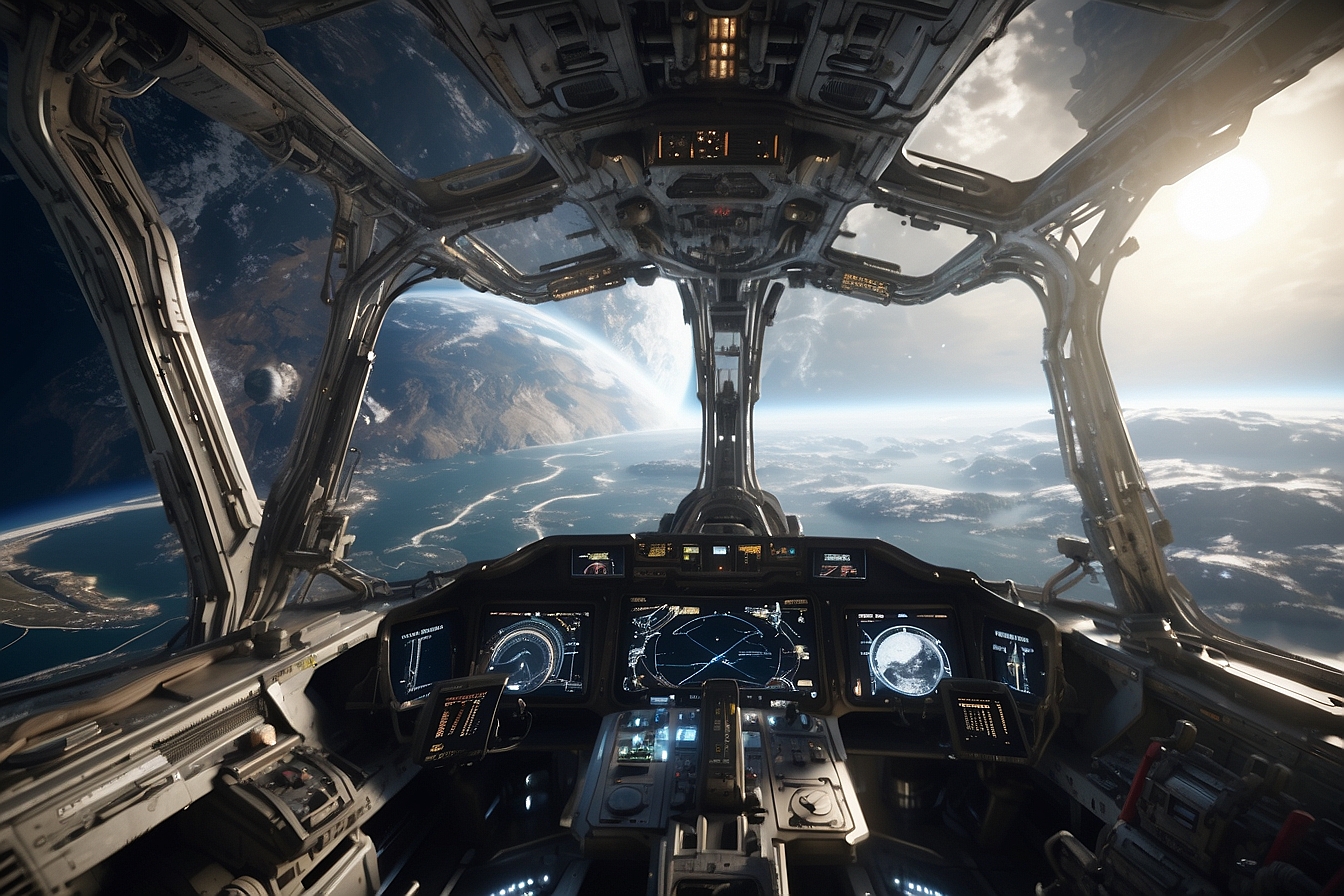
Space Navigation Systems: Navigating the cosmos has become one of humanity’s most intriguing and complex endeavors. As we venture beyond Earth’s orbit, traditional global positioning systems (GPS) are no longer sufficient for the vastness of space. In response to this challenge, scientists and engineers have been developing advanced navigation systems specifically designed for space travel. These systems must reliably provide precise positioning and timing information, allowing for safe and accurate interplanetary and, potentially, interstellar travel.

The evolution of space navigation technologies marks a significant milestone in our quest to explore the stars. Early methods relying on celestial navigation have given way to sophisticated techniques that can determine a spacecraft’s location using pulsars and other cosmic landmarks. These advancements in navigation not only enhance our current space missions but are also paving the way for future journeys beyond the solar system. As we contemplate the complexities of navigating the galaxy, it is clear that innovative solutions and international collaboration are essential in ensuring that space travel continues to push the boundaries of what is possible.

Navigating through space requires understanding the basic principles that allow spacecraft to traverse the cosmic ocean. This section explores the foundational elements of space navigation, from established Earth-based systems to the challenges presented by the vastness of deep space.
Global Positioning System (GPS) is a vital technology that provides geo-spatial positioning with remarkable accuracy. It involves a constellation of satellites orbiting Earth, which transmit signals that allow GPS receivers to determine their exact location. The system is instrumental for navigation on Earth, from guiding cars on city streets to plotting courses for international air travel.
Despite its efficacy on our planet, GPS signals become exceedingly weak as one moves into deep space, far beyond the Solar System. The vast distances involved dilute the strength of the signals, making it unreliable for navigation beyond a certain point. Consequently, deep space missions require alternative methods to determine spacecraft positions with the needed accuracy.
With the advent of space exploration, traditional GPS systems are no longer sufficient. As humanity reaches out towards the stars, advanced navigation technologies are being developed to ensure that space vehicles can find their way across the cosmos with precision and reliability.
Pulsar Navigation Systems utilize rapidly spinning neutron stars known as millisecond pulsars, which emit beams of electromagnetic radiation at regular intervals. These predictable pulsations serve as highly accurate cosmic lighthouses, allowing spacecraft to triangulate their position in space. This method of using the timing from millisecond pulsars as a galactic GPS could navigate with unparalleled accuracy.
Deep Space Atomic Clocks are highly accurate time-keeping devices, essential for precision navigation in space. The incorporation of an atomic clock into spacecraft systems allows for autonomous determination of location by measuring the signal delays from Earth. This technology is imperative for real-time navigation and plays a crucial role in the synchronization of systems and data collection.
Autonomous Navigation Methods are pivotal for the distant journey of space probes and crewed missions alike. Advanced algorithms and sensors enable a spacecraft to determine its location and adjust trajectory without the need for constant communication with Earth. Northrop Grumman has contributed to this field by creating navigation technology allowing spacecraft to maintain course, even when navigating the remote regions of space. This autonomy is vital since communication delays become significant the further a mission strays from Earth.
These technologies are key to ensuring that as humans venture deeper into the unknown, they can rely on robust systems to safely traverse the vastness of space.
Precision in space navigation is pivotal as we venture beyond the Global Positioning System (GPS). The instruments and systems developed for this purpose must not only be accurate but also reliable over vast distances and long durations in space.
Inertial Measurement Units (IMUs), such as the LR-450, are critical for both the sensing and stabilization of spacecraft. These units consist of a combination of accelerometers, gyroscopes, and sometimes magnetometers, which together measure linear acceleration and rotational rates. This data enables the spacecraft to calculate its velocity, orientation, and trajectory.
Hemispherical Resonator Gyros (HRGs), and their advanced version, the Milli-Hemispherical Resonator Gyroscope (mHRG), provide highly reliable and accurate sensing capabilities crucial for spacecraft navigation and attitude control. Often included in systems like the Scalable Space Inertial Reference Unit (SSIRU), HRGs offer long-lived performance with low drift rates, which is essential for deep-space missions where minimal maintenance is possible.
The integration of atomic clocks with space navigation systems provides unprecedented accuracy in timekeeping. Atomic clocks, such as those on satellites for GPS, maintain a precise time standard that is critical for high-precision navigation calculations. Their stability and accuracy are beneficial not only for the positioning of spacecraft in relation to the Earth but also for potential deep space network communications and autonomous navigation.
Navigating through the vast expanse of space poses unique challenges that surpass the complexities encountered in earthly travel. Stellar distances and cosmic phenomena demand innovative solutions for accurate positioning and course plotting.
Navigating within the Milky Way involves traversing distances that are incomprehensible on a human scale. Conventional GPS technology, which relies on a network of satellites orbiting around Earth, falls short when it comes to galactic travel. Instead, navigators must utilize natural cosmic landmarks. Pulsars, rapidly spinning neutron stars, emit beams of electromagnetic radiation that can serve as precise celestial lighthouses, aiding spacecraft in pinpointing their position accurately across interstellar distances.
Cosmic phenomena can influence interstellar navigation systems in unpredictable ways. For example, the gravitational pull from large objects, like stars within the solar system, can bend the path of light and radio waves, leading to potential navigational errors. Similarly, charged particles from the sun can interfere with instruments, causing disruptions. To counteract these issues, advanced shielding and corrective algorithms are necessary. Careful consideration and calibration are especially critical when navigating near massive celestial bodies such as Venus and Mars, where gravitational forces and atmospheric effects can significantly affect trajectory calculations.
Navigating through the cosmos requires sophisticated technology beyond the GPS systems used on Earth. This section explores the advanced navigation systems employed in some of the most pioneering space missions.
Voyager 1 and Voyager 2 are probes that have been traversing space since their launch in the late 1970s. They rely on a Deep Space Network to communicate with Earth, and their positional data is used to fine-tune their trajectories. New Horizons, which provided the first close-up photos of Pluto, relies on star trackers and onboard thrusters for navigation, making precise adjustments to maintain its course through the Kuiper Belt.
Mars missions, such as those involving the Perseverance Mars rover, employ an array of advanced navigation systems. These rovers use a combination of gyroscopes, accelerometers, and star tracking to traverse the Martian terrain effectively. The Mars orbiters, crucial for relaying communications between the rovers and Earth, utilize similar technology. NASA‘s expertise in this domain has been instrumental in the success of these missions, contributing to the extensive knowledge humanity has about Mars.
The realm beyond our solar system beckons with opportunities for discovery and challenges for navigation. Innovations point toward novel systems for guiding spacecraft through the vastness of interstellar space.
With the expansion of space exploration, traditional navigation systems like GPS, limited to Earth and its immediate environment, are inadequate for galactic travel. NASA and other space agencies are developing concepts that operate on a cosmic scale. A navigation system for interstellar space relies on different celestial cues, leveraging the consistent pulsations of distant astronomical objects, such as pulsars, to guide explorers across the enormous distances between stars.
Artificial intelligence (AI) significantly advances autonomous navigation, essential for the long durations of interstellar voyages where real-time communication with Earth is impractical. One such system demonstrated by NASA uses X-rays from pulsars to navigate with impressive accuracy. AI-driven pathfinding algorithms can process vast amounts of complex data from various sensors, adjust the spacecraft’s trajectory in real time, and navigate through dynamic environments, such as near Venus or beyond the known confines of space. This autonomous ability is crucial in ensuring that future probes and crewed vessels can safely reach their far-flung celestial destinations.
In the quest for stellar exploration, collaborative efforts between international space agencies and organizations are crucial. These initiatives are designing the future of navigation beyond our planet, uniting expertise from around the globe to propel us into the cosmos.
Cooperation among space agencies is exemplified by the International Space Station (ISS), a symbol of global partnership. The ISS represents a microcosm of international collaboration with agencies like NASA, Roscosmos, ESA, JAXA, and CSA working together. Contributions also come from commercial partners like Northrop Grumman, which provides cargo resupply missions to the station. Coordination extends to developmental projects for navigation systems capable of withstanding the harsh conditions of space – including radiation-hardened components vital for the reliability of equipment in the solar system and beyond.
The development and deployment of an immense Global Positioning Infrastructure is a testament to global collaboration. With each space-faring nation contributing, the infrastructure is diversified – China operates its BeiDou navigation system, while the US maintains the well-known GPS system. Notably, the James Webb Space Telescope, featuring technologies such as a state-of-the-art sunshield developed in Maryland, is set to revolutionize our understanding of the universe. These devices utilize sophisticated navigation technologies to maintain precise positioning, ensuring accurate data is relayed back to Earth.
In the sphere of space exploration, the evolution of navigation systems extends far beyond terrestrial GPS capabilities, supporting both commercial endeavors and scientific research missions. These advancements not only enhance the efficiency of satellite operations but also deepen our astronomical knowledge.
The utilization of sophisticated navigation systems in commercial satellites and spacecrafts has revolutionized communication, observation, and data collection. Companies deploying commercial satellites benefit from enhanced sensing capabilities and attitude control, essential for tasks such as weather forecasting, environmental monitoring, and global communications. For instance, the Station Explorer for X-ray Timing and Navigation (SEXTANT) recently demonstrated that millisecond pulsars can be used for autonomous navigation, akin to a galactic GPS, showcasing the practical applications of advanced space navigation in commerce.
Research missions, such as the Messenger and Cassini missions, have provided invaluable data about our Solar System. These missions rely on precise navigation to conduct their explorations and accomplish their objectives. Currently, telescopes like the James Webb Space Telescope and the upcoming Nancy Grace Roman Space Telescope capture the universe’s earliest light. Meanwhile, the Spherex Observatory mission is set to survey the sky in the near-infrared, mapping galaxies across the entire sky every six months, demonstrating the indispensable role of space navigation in augmenting our understanding of the cosmos.
Navigational techniques have evolved significantly, enabling precise travel across the Solar System and beyond. Today’s tools integrate advanced technologies for accurate orientation and positioning, crucial for deep space missions.
For a spacecraft to navigate successfully, it must determine its orientation and position within the vast cosmos. This is achieved through a combination of hardware and software technologies, solar system dynamics, and celestial mapping. A key instrument in this endeavor is the sextant, a device inspired by historical maritime navigation but adapted for space use. It helps in pointing the spacecraft by measuring angles between stars or other celestial bodies.
Positioning also relies on understanding the range relative to known objects. One cutting-edge technology being explored is the use of X-ray pulsars; these celestial objects emit highly predictable X-ray signals which, much like lighthouses for ships at sea, act as fixed beacons in the universal expanse. The Detector of the X-ray signals aboard the spacecraft, a part of the NICER experiment on the ISS, is essential for XNAV, which could allow navigation without reliance on Earth-based systems.
Deep space travel demands robust communication systems to transmit and receive data over vast distances. Radio signals have been the mainstay of space communication, often facilitated by networks like NASA’s Deep Space Network (DSN), managed by the Jet Propulsion Laboratory (JPL). This system relies on large antennae across the globe to maintain continuous contact with spacecraft.
Additionally, there’s ongoing development in laser communication technologies, offering the potential for faster data rates. Upgrading communacation systems, both for operational needs and data exchange with Earth, is seen as pivotal as humanity pushes the frontiers of exploration. Communication technology enables not only navigation but also the transmission of valuable science data back to Earth, closing the loop on the human quest to explore and discover.

In navigating the cosmos beyond Earth’s orbit, sophisticated systems and technologies come into play. This section covers some of the most commonly asked questions about space navigation systems and their role in interstellar exploration.
Optical navigation utilizes high-resolution images of planets, moons, and other celestial bodies. These images are analyzed to determine the spacecraft’s location relative to known landmarks on these bodies, facilitating precise maneuvering within planetary systems.
The Deep Space Network (DSN) is a global network of antennas that provides communication services for interplanetary spacecraft. It tracks spacecraft locations, sends commands, and relays data between Earth and the spacecraft, which is crucial for navigation and mission control.
Spacecraft are often equipped with star trackers and sun sensors that measure their orientation by the positions of stars and the Sun. Gyroscopes and accelerometers also provide information about the spacecraft’s rotation and velocity, essential for celestial navigation.
In the absence of GPS, space navigation relies on a combination of radio signals, celestial observations, and onboard instruments. These methods allow the spacecraft to triangulate its position relative to the Sun, planets, and stars for accurate solar system navigation.
GPS signals become weaker and eventually undetectable as the distance from Earth increases. They are limited to near-Earth space and are not designed for the vast distances encountered in deep space travel and exploration.
Spacecraft use a method called pulsar-based navigation, which relies on the consistent timing of light pulses from distant neutron stars called pulsars, acting as universal lighthouses. This allows spacecraft to determine their position with remarkable precision, enabling them to navigate through space.